Community & Business
30 November, 2023
TRC’s Walking Network Plan
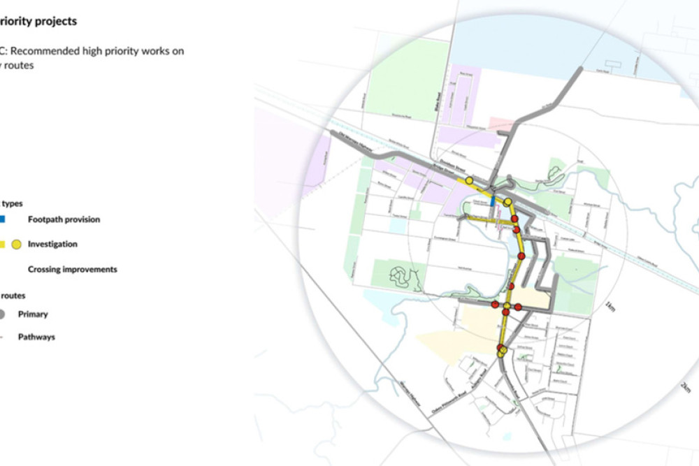
Toowoomba Regional Council (TRC) has developed a Walking Network Plan for Oakey which prioritises improving crossings in and around Campbell Street.
TRC commissioned Zwart Transport Planning to undertake the Walking Network Planning process and develop a Priority Works Program (PWP) for Oakey.
TRC secured funding to undertake the WNPs through the Queensland Department of Transport and Main Roads’ (TMR) Walking Local Government Grants as way of achieving the Queensland Walking Strategy 2019-2029 vision of “making walking an
easy choice for everyone every day” (Queensland, 2019).
The PWP recommends actions to achieve improved walking environments on the key links identified in the WNP, with works identified to achieve the agreed vision for walking in Oakey.
Extensive consultation activities were undertaken including stakeholder work-shops, pop-ups, have your say website and meetings with RAPTAC, Walking Discussion Group and Cycling Discussion Group, supported by two Councillor Information Sessions.
The high priority actions aim to achieve a step change towards this vision and achieve improved safety, accessibility and maintenance of facilities for people walking in Oakey.
Overall, the actions aim to improve walking conditions for all ages and abilities, both to and around key destinations within the precinct.
Infrastructure Committee Chair Cr Carol Taylor said the plans would set the direction for improved connectivity of walking paths in the Oakey town centre.
“Wherever possible, we’re trying to encourage active transport throughout the Region,” she said.
“If we can create better places to walk, active transport becomes a more attractive and accessible choice for both transport and recreation.
“In creating these plans, we engaged extensively with the community and sought feedback on items like new and upgraded footpaths, safe crossings and the need for supporting measures such as shade trees, lighting and seating.
“Thank you to everyone in the community who provided feedback.
“The Walking Network Plans identify key destinations at each location and aim to connect these places by identifying potential walking routes.”
Each Walking Network Plan covers an area based on a 2 kilometre radius from the primary destination.
The primary destination for these locations is, the town centre for Oakey, the Mary McKillop Catholic College for Highfields and the Margaret Street / Ruthven Street intersection for Toowoomba.
The Council says it is appreciative of the Walking Local Government Grants from the Department of Transport and Main Roads (TMR) which help the development of the three Walking Network Plans.
The works above are only the recommended high priority works and a graphic of the Walking Network Plan (Figure A) and Recommended Works (Figure B) is available from the Oakey Champion on request via editorial@oakeychampion.com.au