26 November, 2021
Oakey parks turn into rivers following periods of heavy rainfall
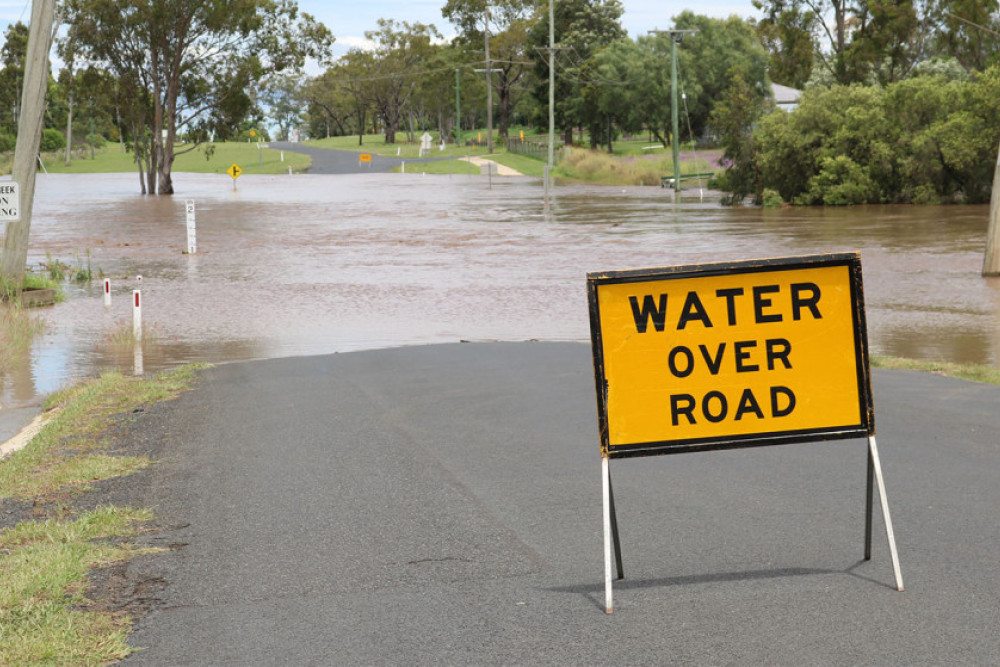
With local paddocks and waterways already soaked from heavy rainfall earlier in the month, the Oakey district was not able to cope with the deluge of water recorded between Sunday night (21st November) and Monday morning (22nd November) with roads becoming blocked and local parks turning into rivers.
The official local weather station located at the Oakey Airport recorded 45.4mm between 9am Sunday 21st November and 9am Monday 22nd November.
This total is far less than other figures reported from local residents which sit between 60mm and 80mm.
It is reported that most of these totals were received in just one hour.
The heavy rainfall caused several roads to become undrivable including the low-lying section of Lorrimer Street, parts of Kelvinhaugh-Yalangur and Kingsthorpe-Haden Roads as well as other rural roads feeding off these arterial roads.
Trevor Flynn from the Oakey SES said that the team was not called to any emergency incidents at the weekend.
He said he hopes this continues throughout the rest of the year.
If you need immediate assistance or for help preparing a property that is in some danger from flood waters or storms contact the SES on 132 500.
Sand bags may be available if needed.
To keep up-to-date with any weather warnings or to see the local weather radar head to www.bom.gov.au
To see which major roads are impacted by flood waters go to Toowoomba Regional Council's Disaster Platform at http://disaster.tr.qld.gov.au
This platform also provides local people with access to the Oakey and Jondaryan flood camera images which have images of Oakey Creek and Lagoon Creek updated every 15 minutes.
The images can be accessed at the dashboard by clicking on the ‘Flood Cameras’ tab, then the relevant location, e.g. ‘Oakey Creek – Oakey' and then on the camera icon that will appear on the map.